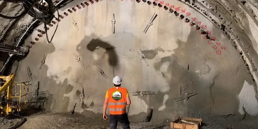
Port Macquarie's transformation from a penal settlement in 1821 to a coastal city of over 50,000 has pushed construction onto the weathered argillite and Quaternary dune sands that fringe the Hastings River. The Kooloonbung Creek floodplain and the slopes below Transit Hill present two very different excavation challenges: soft, saturated alluvium on one side, and stiff residual clay with potential block falls on the other. When a cut goes deeper than 2.5 metres in these materials, the risk of basal heave or face sloughing is real, not theoretical. Our excavation monitoring programme ties directly into the site-specific ground model, combining automated total stations with load cells on struts and inclinometer casings behind the wall. For projects near Settlement Point, where marine clay layers interbed with clean sand, we often correlate the monitoring data with a prior CPT test to understand pore pressure dissipation before excavation begins. The goal is simple: keep the shoring deflection within the 0.5%H limit that AS 4678 implies for sensitive adjacent structures.
Deflection limits are not a target—they are a boundary. In Port Macquarie's interbedded sands, we trigger a review at 80% of the design threshold, not at 100%.
Scope of work
Area-specific notes
Port Macquarie gets over 1,200 mm of rain annually, and February–March storms can dump 150 mm in a single day. A dewatered excavation in the clayey sand of the Lighthouse Beach area can turn into a sump in under two hours if the pumps can't keep up, and rising groundwater behind a sheet pile wall adds hydrostatic pressure that the monitoring system must capture immediately. The diurnal tide range of up to 1.8 metres at the Hastings River mouth also influences pore pressure in excavations within 300 metres of the shoreline; we have seen piezometer readings swing 15 kPa between low and high tide. Temperature swings are less dramatic, but a 20°C change between a winter morning and a summer afternoon will produce measurable thermal expansion in the steel struts—roughly 0.24 mm per metre of strut length—which can be mistaken for load increase if not corrected. Our alarm protocol distinguishes between thermal cycles, tidal effects, and genuine ground movement so the civil contractor is not chasing ghosts. In the weathered rock cuts along Oxley Highway, the main concern is rainfall-triggered wedge failure on joint sets dipping toward the excavation, and we couple the monitoring with a slope stability assessment whenever the cut face is steeper than 1H:2V.
Standards used
AS 4678-2002 Earth-retaining structures (design and monitoring), AS 1726-2017 Geotechnical site investigations, AS/NZS 1170.0:2002 Structural design actions – General principles, AS 2187.2-2006 Explosives – Use of explosives (vibration limits)
Linked services
Shoring & Retaining Wall Monitoring
Continuous deflection tracking on soldier pile and shotcrete walls using in-place inclinometers and total station prisms, with load cells on tie-back anchors. We set amber and red alarm levels based on the incremental deflection rate, not just total displacement, in line with the observational method of AS 4678.
Groundwater & Pore Pressure Control
Vibrating wire piezometers installed in sand packs at multiple depths behind the excavation face, logging pore pressure at 15-minute intervals. The data is correlated with the local tide gauge at Port Macquarie to separate tidal influence from consolidation-driven pressure changes in the estuarine clay.
Vibration & Settlement Monitoring
Triaxial geophones and settlement points placed on adjacent residential slabs and heritage structures, particularly in the Hill Street precinct. Trigger thresholds are calibrated to AS 2187.2 for rock breaking and to the contractor's plant-specific vibration curves for hydraulic hammering.
Typical parameters
Top questions
How much does geotechnical excavation monitoring cost for a typical Port Macquarie residential cut?
For a single-level basement excavation with one row of anchors and an adjacent dwelling, the monitoring programme usually falls between AU$1,360 and AU$4,000. The spread depends on the number of instrumented sections, the duration of monitoring, and whether we include automated vibration units. A fixed quote is provided after reviewing the shoring design and the site-specific ground investigation report.
What is the minimum monitoring frequency once the excavation reaches final depth?
We typically log inclinometers and survey prisms twice daily during active excavation and once daily during the open-cut phase. After the base slab is poured and the struts are pre-loaded, we can drop to weekly readings if the deflection rate has stabilised below 0.1 mm/day for two consecutive weeks. The frequency is always locked into the site-specific monitoring plan, not copied from a generic template.
Which AS 4678 alarm thresholds do you apply to shoring walls in Port Macquarie?
We follow the deformation limits recommended in AS 4678 for the relevant consequence category. For a Category 2 structure—such as a shoring wall adjacent to a public road—we typically set the amber alarm at 0.3% of excavation height and the red alarm at 0.5% of excavation height, or 25 mm, whichever is reached first. The alarm is sent by SMS and email within the same logging interval.
Can you monitor excavations that are within the tidal influence zone of the Hastings River?
Yes, and it is one of the situations where real-time piezometer data becomes critical. We install standpipe and vibrating wire piezometers with barometric compensation and compare the recorded pressure against the predicted tidal lag. If the pore pressure exceeds the design envelope assumed in the shoring calculations, we recommend contingency dewatering or a temporary berm until the tide cycle shifts.
Do you need a separate surveyor, or is the monitoring system self-contained?
The reference range for this service in Port Macquarie is AU$1.360 - AU$4.000. The final price depends on the project scope and volume.